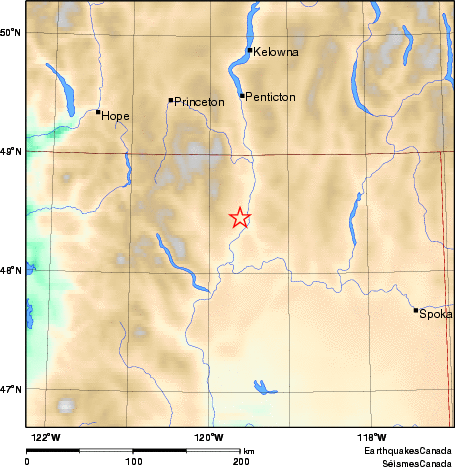
Earthquake Details (2011-11-18)
Friday November 18, 2011
| Local Time: | 05:09:01 PST |
|---|---|
| Magnitude: | 4.3 ML |
| Latitude: | 48.47 North |
| Longitude: | 119.61 West |
| Depth: | 13.76 km |
| UT Date and Time: |
2011/11/18 13:09:01 UT |
Did you feel it?
Approximate Location of Earthquake: We have received no reports of damage at this time. Felt in Penticton, Rock Creek, Kelowna, Grand Forks and other south-central BC communities.