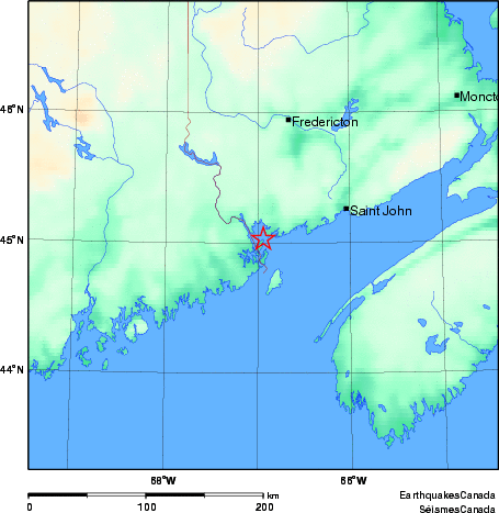
Earthquake Details (2010-08-25)
This is an archival version of a significant seismic event report. For the latest version go to https://www.earthquakescanada.nrcan.gc.ca/eqpages/en/
Wednesday August 25, 2010
| Local Time: | 05:16:02 ADT |
|---|---|
| Magnitude: | 2.4 MN |
| Latitude: | 45.03 North |
| Longitude: | 66.94 West |
| Depth: | 5.00 km |
| UT Date and Time: |
2010/08/25 08:16:02 UT |
Did you feel it?
Comments:
- 11 km SE from Saint Andrews, NB Felt.
- Felt on Deer Island by several people.
- NORTHERN APPALACHIANS SEISMIC ZONE.
Approximate Location of Earthquake: