Earthquake Details (2011-09-09)
This is an archival version of a significant seismic event report. For the latest version go to https://www.earthquakescanada.nrcan.gc.ca/eqpages/en/
Friday September 09, 2011
| Local Time: | 12:41:30 PDT |
|---|---|
| Magnitude: | 6.3 Mw |
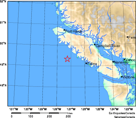
| Latitude: | 49.34 North |
| Longitude: | 127.26 West |
| Depth: | 22 km |
| UT Date and Time: |
2011/09/09 19:41:30 UT |
Did you feel it?
Comments:
- 3 P.M. PDT UPDATE. This earthquake occurred about 50 km off the west coast of Vancouver Island, and 300 km west of Vancouver. It was felt across southwest British Columbia, including Vancouver Island, Greater Vancouver, and as far away as Kelowna. There have been no reports of damage. The last large earthquake in this area was a M 6.6 event on November 2, 2004.
- 13:00 PDT September 11 - Aftershock Update: Friday's M 6.3 earthquake off the west coast of Vancouver Island was followed by more than 100 aftershocks. The largest aftershock occurred 3 minutes after the earthquake and had magnitude 4.9. The remaining aftershocks were in the magnitude 1-3 range and approximately 50 km offshore, thus too small and too far offshore to be felt or cause any damage. The rate of aftershocks has been decreasing steadily, down to near zero during the past few hours.
- Preliminary list of the largest aftershocks:
- Sept 9 19:44 UTC M 4.9 49.45 -126.53
- Sept 9 19:59 UTC M 3.3 49.49 -127.32
- Sept 9 20:09 UTC M 3.6 49.53 -127.12
- Sept 9 23:08 UTC M 2.6 49.34 -126.58
- Sept 11 10:52 UTC M 2.9 49.32 -127.50
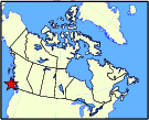
Approximate Location of Earthquake: